


At 6288 feet, Mt Washington is the highest point in the northeastern US. Something interesting to note here is that when Cathy and I went to Colorado, we rode up Pikes Peak which is over 14,000 feet...the interesting part is that we thought this road was actually steeper than Pikes Peak!!! We went back and looked at the blog and noticed that to go up Pikes Peak we had to drive 28 miles, while we did this in 8 miles. If you do the math you will notice that this is a much more direct route, therefore it is indeed a steeper climb.


If you follow these 6 pictures you will notice that as we go up the mountain the trees get smaller and smaller, until the point where you reach the summit you are surrounded by nothing but rocks.


If you click on this picture as we crest near the top you can see the moon...pretty!

Out of the car, sweatshirts on and eating my chili for lunch. Just as we stood there over about 10 minutes the clouds started to come in.


You have to walk the final staircase to the summit. On a clear day, you can see 5 states (ME, NH, VT, MA, NY) and Canada from here.


In the stitch picture on the left, if you click on it you can see 2 of the trains that take passengers heading back down the mountain. They look like tonka toys out there. The railway was built in 1869. I am out on the observation deck looking at what's called The Presidential Range. They have recorded 147 deaths of people hiking these mountain ranges, most from hypothermia, with the most recent happening on 1 April 2012...in the range directly behind me.


Check out the view from the summit.
Rehabbed hotel built in 1853 at the summit for tourists. I am looking at the stove thinking it may have been harder for me to cook all my barley back then! haha And then I am in the bunk room...the last pic I am actually spreading my arms out to show how small these "beds" are. I assume I have a wingspan of about 5 ft, so only midgets must have been allowed up there way back then.


The Presidential Range was really misnamed originally, with the peak on the left named Mt Clay...since re-named to Mt Reagan to keep the "presidential" part of the name authentic.

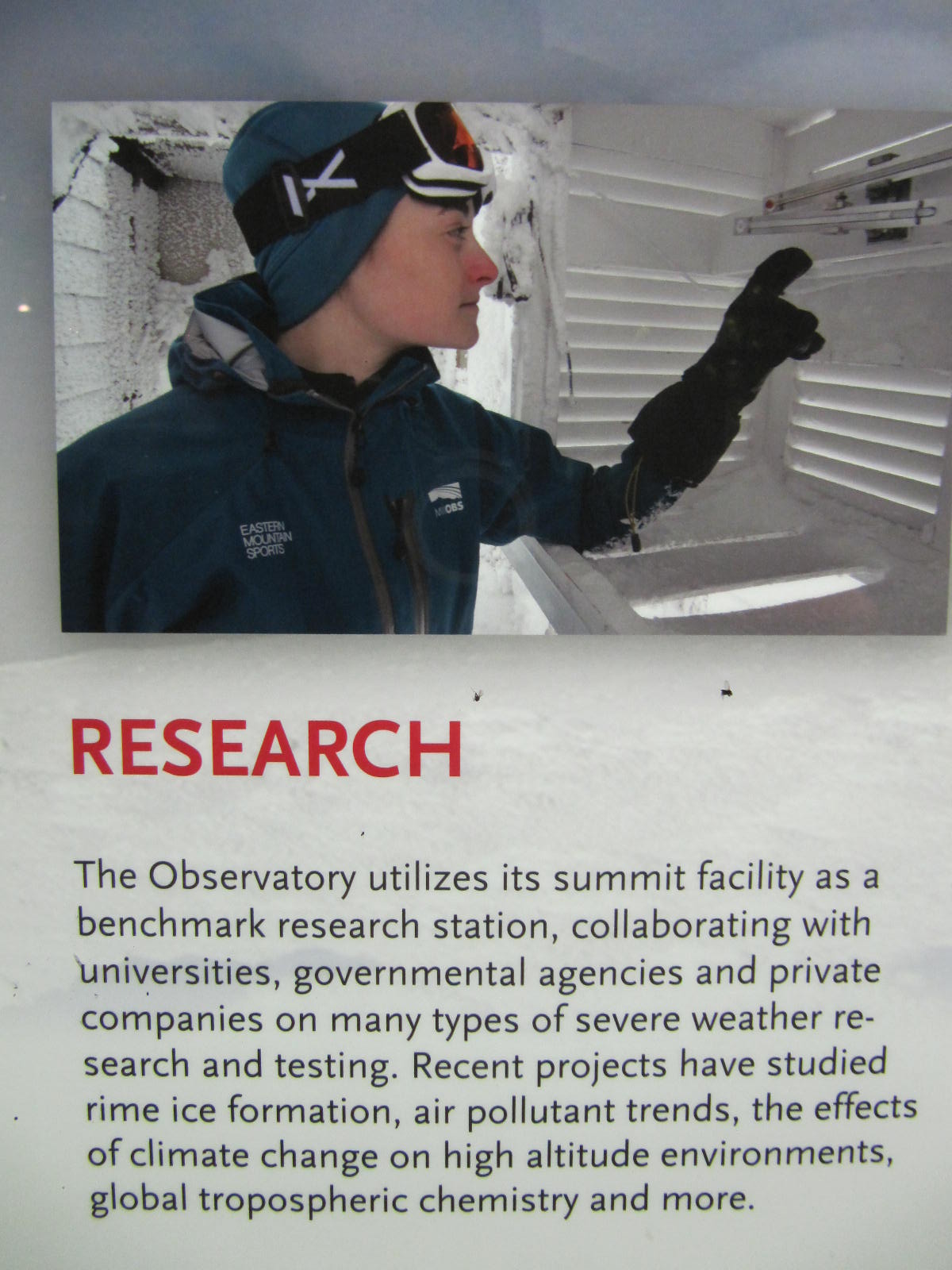
The actual purpose of the observatory up here is for research and weather observation...but enough about that...we are ready to go back down the mountain.


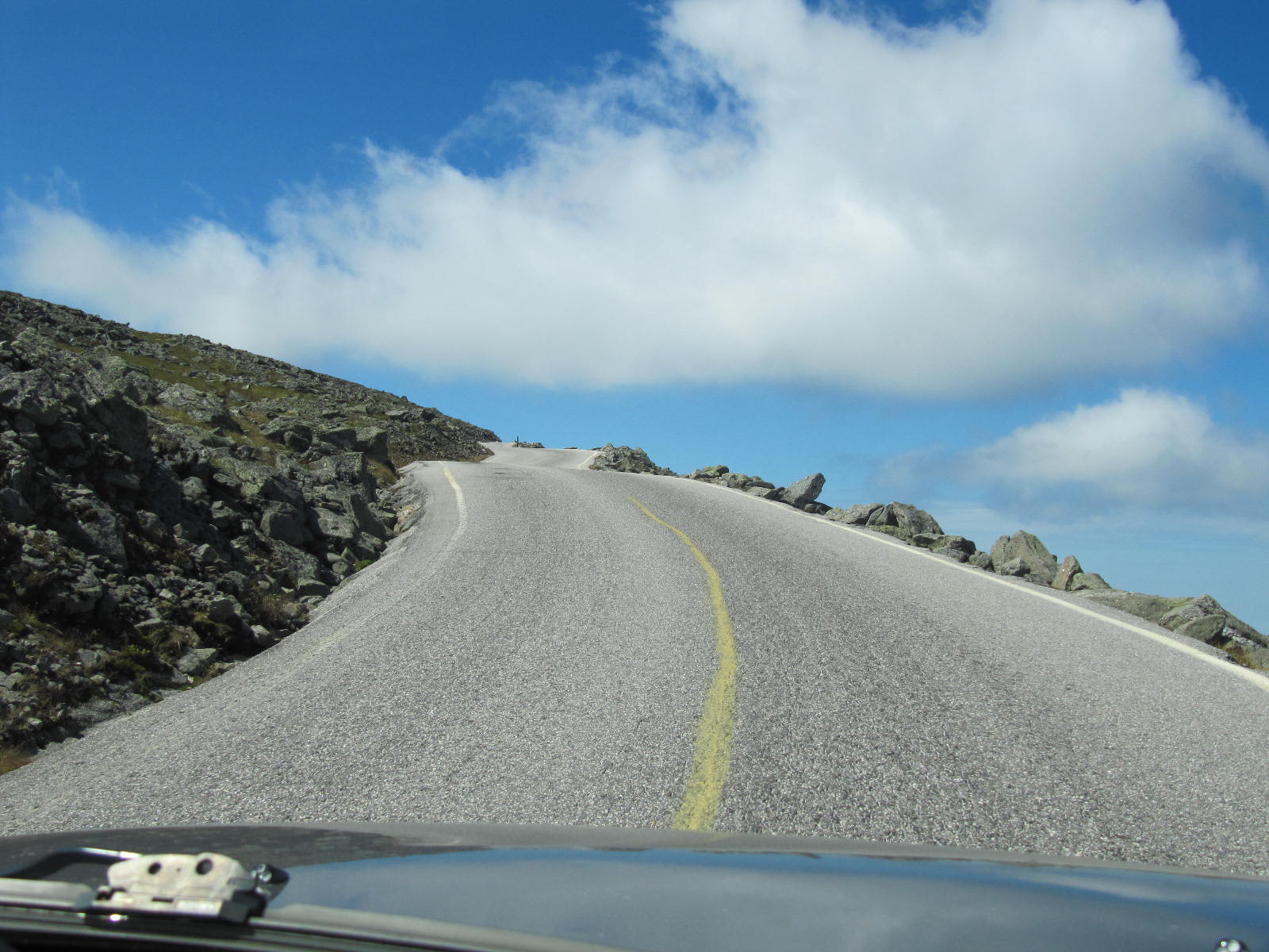
As I said earlier, this road is pretty steep, and not for the faint of heart. Notice the curve in this road as we get started.
And check out these "road hogs"!!!
This poor slob went off the side of the road and had to call for roadside assistance to get him out out of the ditch. Lucky for him that he wasn't on the other side of the road when his wheels slipped off.

We stopped a few times to let our brakes get a breather...Cathy looks like she's standing in a Christmas tree farm.

Down again at the base of the mountain visiting the Red Barn Museum, a small place with some wagons and cars on display that have actually gone to the top of the mountain or are examples of ones that have. I cannot even imagine going up and down this mountain in a coach, never mind racing a car down to see how fast I can do it!!! The current record is 6 minutes and 11 seconds set in 2011. CRAZY!


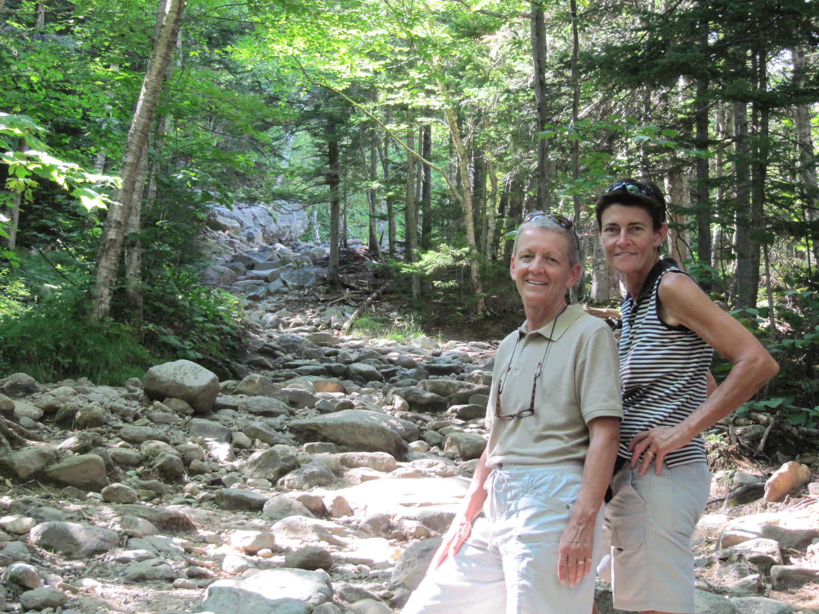
From Mt Washington we drove a few miles down the road to Pinkham Notch to hike to a waterfall we had read about. It was just under a 1/2 mile hike to get there, so we headed out.


Cathy was trying out some techniques she learned in her photography class on our way up. If you click on the 1st 2 pics, especially the 2nd one, I look like I am cut and pasted into the picture. She slowed the shutter speed down to make the flowing water look different, but instead it makes me almost look fake. haha


At Crystal Cascades, the waterfall we were looking for. Cathy is initially up above me on a rock to get the best angle for the pic...and then runs down at the end to get in the last picture.


Beautiful day again! Keep'm coming!!!
Hello sisters. Nice pictures. by the way, you're looking great sister Paula, sorry you're both looking great. I like Cathy's "Hoody" can you bring me one? of course I will pay for it. I want it in green. Thank you and have fun( for me too).
ReplyDeleteLove you all.
This was one of your best blogs, very interesting and great pictures!
ReplyDeleteYou are right, you look like you were put into some of the pictures!
Are you really saying that you don't like my state capitol bldgs blog??? haha
DeleteCathy you are getting to be a pro at the camera. They were great pictures. Paula you are looking great!!!! You know the saying wish you were here, well I wish I was there.
ReplyDeleteI wish we could have a little caravan going like we did out west Carol!!! Saddle up!
ReplyDeleteYou may want to reach out to Walter, Julie, Chris Foley; dad used to take them there often. b
ReplyDeleteI love the waterfall pics. Great photo job. For the driving - with no guard rail I'd be a road hog also. I'm glad you didn't ride up there with the RV.
ReplyDeleteThe stove looks a lot like the one nana had on "L" Street.
Guess I won't ever be visiting Mt. Washington.
ReplyDeleteCouldn't they have named the mountain after oh I dunno, Lincoln, or the 5th President, Monroe, since the others are the first 4 (Mt Washington inc), Reagan..geez he's not even from the NE.
You totally look photoshopped. I think maybe because your color is lighter than the background.