


Ellen and Eleanor, this section is for you! I know you almost get sick looking at pics of us close to the edge, but what about these idiots? In the 1st pic is a father with his little girl on his shoulders...he took her out to the edge after having his even littler boy out there with him. And the woman in the 2nd pic? That is the wife of the guy in the 1st pic...with their infant attached to her chest!!!


And check out these idiots! If you look at the first pic, on the bottom, you can see a railing...that means to me they don't want us on the other side of the bars. But someone dared this guy to go out there, he went, and his stupid wife/girlfriend joined him. Between the parents above, and these 2 out on the rocks, I was a nervous wreck watching them.


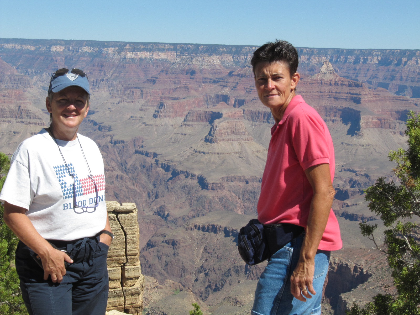
Cathy, of course, couldn't stand that other people were making me nervous, so she had to head out on what looked to me to be very unstable chunks of rock. Look at all the cracks in the 1st pic, and then at Cathy in both the 1st and 2nd.


At these spots we were just playing around...totally safe!!!


OK, now for our hike. Before we could even get on the trail to the named points on the map, we had to walk close to a mile along the rim. While walking we looked back and saw this lodge on the edge of the rim opposite us. Just think, people pay money to stay here...a mere mudslide away from disaster!

One of the trails we would like to hike on if my back gets better can be seen here. If you blow up the pic you can see people walking alongside the mountain as they make their way down the trail.

Here are a few shots of areas we saw on our way up to the trail. Check out the farthest rock to the right in the 2nd pic...the 3rd pic shows a close-up of it, and the lone tree growing in it! How bizarre!


Maricopa Point was the 1st stop on the trail. Here they told us how this area used to be mined for uranium, up until 1969. That surprised me. If you look at the middle/top pic, it doesn't even seem it is the same area as the bottom 3 pics. But it is.


At Powell Point, I thought I would try something new. I keep trying to show you the "whole" canyon, but even with a stitch pic all I can get is the top of the canyon, or somewhere in the middle, nothing showing how deep this actually is. So, here I am showing normal pics in the first 3, but then look at the next 3, stacked on top of each other. I tried to line them up so you could see how deep this canyon actually is. Remember, it averages a mile deep, and that is over 5200 ft!!!


Powell Point stacked: when you look at them you can see where one leaves off and the other starts.


At Hopi Point they talked about pollution, and no more than our surprise in Utah at their pollution, there is definitely pollution here. Sometimes I am not sure if the pics are being bleached out because the other side is so far away, or is it the pollution fogging everything up? The bottom line though, is that even with the pollution, this place is beautiful!


No eye-opening info to be had at Mohave Point, just beauty!


I am not really interested in the different "types" of rock that are here...I only like looking at them. But at Abyss Point they broke down the different layers and showed what time frame they were formed in. Anyone else interested?


They also talked about Point Sublime, 11 miles across the canyon on the north side. It is the point in the 2nd and 3rd pics that are higher than anything else.


The 2nd last viewing point was called Pima Point, and they should have ended the trail here. Instead, they led us to what is called Hermit's Point, but all they had there was a tourist shop for you to buy their t-shirts, etc. Pima Point had some great views, so I will do what they should have done, and end it here! (By the way, Cathy and I had walked exactly 5 miles before getting on the bus for the last 2 points, so there were no sunset pics tonight...we were a little beat!)


The worst part about these idiots is their families will sue if something happens to them.
ReplyDeleteWhat do you mean "safe" when you are standing over the cracked rocks????? Didn't look to safe to me!!!
I like the info on the rock formations, it really shows us where everything really came from
ReplyDeleteHallie, That was a stretch!!!
ReplyDelete